At the very top of the Wikipedia article “List of artificial objects on the Moon” is a short disclaimer: Though the list includes more than a hundred objects, it is far from complete. Not included are the “lesser” items littering the lunar surface—the pins, statues, golf balls, plaques, hammers, and memorials that moonwalkers have left behind. Among them is an object called the Lunar Library. It is a kind of ark, designed to preserve an everlasting cultural memory of human civilization. Etched onto a sheet of nickel, in a nano-font so minuscule it can be read only through a microscope, are the complete texts of thousands of great written works from across the ages. Near the top of this final testament of our species is an English-language edition of Wikipedia, the encyclopedia anybody can edit.
Unlike the paper Bible left behind by NASA moonwalker David R. Scott in 1971, the Lunar Library’s form is impervious to gamma radiation and expected to last billions of years. For Wikipedia, being engraved into eternity represented a triumph long delayed. In 2007, it had become the largest encyclopedia ever to exist, ending the reign of the imperial Chinese Yongle encyclopedia after six hundred years. Some called it the first digital wonder of the world, yet it had reached this milestone to meager fanfare. Tributes were muted, and the lone statue monumentalizing its achievement little known, as it stood, for some reason, in the Polish border town of Słubice (pop. 16,000).
So when in 2018 a private moon lander named Beresheet ferried the Lunar Library into orbit, it was an elevated honor in an unusually literal sense. The craft’s languid two-month flight path ended above the moon on April 11, 2019, where it took only a few seconds for seven years of planning to come undone. Beresheet lost contact with its faraway pilots and then dropped through the thin atmosphere, crashing with such force that a glittering nickel disk was flung far across the face of the Sea of Tranquility. The Lunar Library had, in the words of its creator, been turned into a “30 million page Frisbee.” It has never been seen since.
Wikipedia is sui generis, one of the strangest and most outlandish successes of its time, quite unlike what came before it or anything set to succeed it.
At first this bungled tribute seemed another letdown for Wikipedia. But it was, in its way, perfect. The Lunar Library’s unscheduled final flight was a sympathetic homage: unpredictable, chaotic, impervious to control, and more far-reaching than anyone expected. Wikipedia is sui generis, one of the strangest and most outlandish successes of its time, quite unlike what came before it or anything set to succeed it. Since its birth twenty-five years ago, it has become part of the fabric of everyday life, quietly indivisible from the experience of seeking information, a default with no obvious precedent or competitor. For most of its lifespan, it has enjoyed a unique supremacy—not only an encyclopedia, but the encyclopedia, a reference work to end all others.
Though Wikipedia has been consulted trillions of times and read by billions of people, very few of those billions know how it works or where it came from. One of Wikipedia’s many perplexing qualities is the lack of curiosity it provokes. Even those broadly enthusiastic about the encyclopedia sometimes donate money to “pay for the fact checkers,” unaware that it doesn’t have any, or at least not any who are paid. Its public image is intertwined with Wikipedia’s figurehead, Jimmy Wales, in part because pictures of his plaintive face so often accompany appeals for those donations. The face is assuring, kindly, bearded. Wales once compared reading Wikipedia to eating a sausage: “you might like the taste of it, but you don’t necessarily want to see how it’s made.”
Here is part of the paradox that made Wikipedia possible. Its vast scale and reach sprang from an experiment that was radical and even shocking when it was first attempted. Rather than restricting the creation of knowledge to luminaries and experts, it entrusted anyone who wanted to participate, and then let them work how they wanted to. Its status as “the people’s encyclopedia” violated the hierarchy of expertise that preceded it, and still, a quarter-century on, Wikipedia has never quite shaken that first flush of the ridiculous. “Everybody distrusts Wikipedia and everybody uses it,” a cynic once remarked, a reality that held for years. A natural countertendency has formed, especially among its fans, to insist the project be taken more seriously. But that ridiculousness should be appreciated. It had a valuable protective function: Had anyone predicted Wikipedia’s true value during its formative phase, it would never have survived.
This lack of curiosity might explain the scarcity of nonacademic books about Wikipedia. Some of this is prejudice, too. For a time, many writers and journalists disdained Wikipedia as a way of burnishing their own credentials as professionals. They feared—rightly—what might happen if it failed, and when it did work, they fretted that it was working too well. Gather the titles about Amazon, Google, and the other phenomena that define the online world, and together they can cram a bookshop. Wikipedia can barely fill a shelf, and its early period as a “startup” is even less represented. As the lone nonprofit enterprise among its peers, Wikipedia’s story doesn’t belong in the business section. There are no financial numbers to set the stakes, and its cast of characters, with rare exceptions, includes neither executives nor employees. Though a habit of mind places it next to the titans of Silicon Valley, it stands awkwardly apart (this is apt; it didn’t come from Silicon Valley either). It shares the narrative arc of a comedy instead, one of those 1980s comedies where the nerds and misfits beat the rich kids in the big game, although in this big game, the “rich kids” were nerds and misfits too.
Reflect further, and Wikipedia may not belong in the “tech” section either. It is not a technological miracle, at least not in the way a smartphone is. The software that makes it run is well regarded without being revolutionary. Its most important breakthroughs were cultural breakthroughs. Look again at the Lunar Library, and you can see that Wikipedia is an uncanny object. It is vast and tiny at the same time. Its entirety, both text and images, can fit onto a $5 thumb drive. Look it up in Jack Lynch’s history of reference works (called You Could Look It Up: The Reference Shelf from Ancient Babylon to Wikipedia), and Wikipedia’s page count is listed as “zero,” and its size and weight are marked as “none.” Wikipedia has non-Newtonian properties. It is monumental while having almost no distinctive physical presence at all, a confounding effect that makes it hard to appraise. It is both too big to understand and somehow too ephemeral to bother trying.
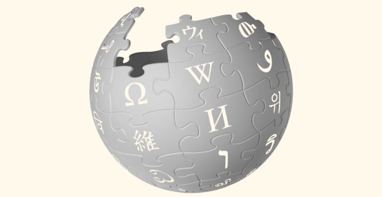
Why try now? The remedial answer would be to say that we should know how it works and where it came from and that this has now become urgent: Thanks to artificial intelligence, more people are using Wikipedia unknowingly than ever before. Delve further, and we strike a more unexpected question. What is Wikipedia? Not everyone agrees it is an encyclopedia, and it is so distinct from everything else called an encyclopedia that it deserves a new name. It could, with justification, be called a hyperpedia, or a massively multi-editor online encyclopedia. But there is no need for new jargon: the word “wikipedia” is itself a coinage, a portmanteau of “wiki” and “encyclopedia.” The word marries two inventions, one from the eighteenth century and one from the twentieth. A modern encyclopedia compiles summaries of knowledge; a wiki is a page on the internet that can be edited by anyone. Each is much more powerful than it first appears. Combining them turned out to be one of the twenty-first century’s most consequential ideas, and one that is still not fully understood or appreciated.
Wikipedia is not only the largest encyclopedia written by humans. It is also the last encyclopedia humans will ever write.
Wikipedia is also an event, a phenomenon in time. It is an act of collective cultural creation—the largest act of this kind in history—that was tightly concentrated between 2001 and 2008, when the present-day form of the project took shape. The conclusion of this period can be identified—it is the moment Wikipedia’s growth rate, once exponential, became linear. We still tend to use the term “digital era” in a hazy, ballpark sort of way, a vague gesture to the number of computers around the place, although the true shift is much sharper. Sometime in 2002, the quantity of digital information in existence overtook the quantity of analog information in existence. It is not a coincidence that the birth of Wikipedia sits at the very center of this process, one of a new breed of informational behemoths.
It is just this critical period where the contemporary coverage of Wikipedia is thinnest. Because it was considered unimportant when it started, crucial moments had little media interest or were neglected outright. Controversies remain unresolved, key figures forgotten, and central strands of its origin story underestimated or ignored. Like any encyclopedia, Wikipedia is also a written work and remains deeply underappreciated as a landmark in the history of writing, reading, and editing. Once seen as a literary production of enormous size, it also turns out to have a hidden pedigree in the humanities.
It might sound pretentious to call Wikipedians heirs to Voltaire, Diderot, and Leibniz (especially if they were listening to Insane Clown Posse at the time), but this turns out to be true in a profound way. Not only do philosophy, literature, and history play a part in this story, but so do less expected influences like architecture and poetry. At a time when the humanities are in eclipse, these legacies are more precious still. They are also responsible for one of Wikipedia’s most unheralded qualities—its beauty. Out of the crooked timber of Wikipedia’s imperfections, wonder has been made. The same distortions that seem squalid or irritating can also make grandeur; Annie Rauwerda, who runs the popular social media account Depths of Wikipedia, compared this sensation of appreciation to stumbling on “abandoned cathedrals.”
Already it is the beauty of something fragile. Younger people only know the encyclopedic form at all because Wikipedia has sustained it. Loss defines the digital age just as much as abundance: Of all the data created in 2020 (a very large proportion of the data that has ever been created), less than 2 percent was saved and retained into 2021. In 2014, the BBC reported that online history was disappearing with breakneck speed, creating what it called “a black hole for future historians.” Reach out to corroborate something from only a few years ago, and often it turns out to be deleted, or corrupted, or trapped on a lost disk in a half-forgotten format. Recent history can feel more remote than the paperbound past that preceded it. Meanwhile, the memories of the people who made Wikipedia, though fading, can still be accessed.
Wikipedia is not only the largest encyclopedia written by humans. It is also the last encyclopedia humans will ever write. Thanks to artificial intelligence, we must apply the new description “human-authored” to Wikipedia, and the circumstances that created it have foreclosed. It is an escapee from a parallel universe, a refugee of the internet as it should have been, instead of the internet as it is. We associate size with strength, but it can introduce weakness as well. Wikipedia could yet drown in a tidal wave of AI slop or be overshadowed by computer-composed encyclopedias of even more unfeasible size. Experiments are already trying to bring such monstrosities to life. Less dramatic ends await Wikipedia too—being broken up into parts or withering through neglect as audiences encounter it in places where it can be read, but not edited. After years of noncombatant status in the culture wars (occupying the no-man’s-land between “trust the experts” and “do your own research”), it has attracted new attention from dangerous political enemies, foreign and domestic.
Digital empires, once fallen, leave few ruins. Wikipedia might not be glittering or extraterrestrial, but this is my attempt at preservation. A means to say: we saw it made, and it was good.
_______________________________
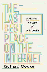
Excerpted from The Last Best Place on the Internet: A Human History of Wikipedia by Richard Cooke. Copyright © 2026 by Richard Cooke. Used with permission of the publisher, W. W. Norton & Company, Inc. All rights reserved.
 Log in